Sunday 31 January 2021

Durham councillors vote against their own pay rise

There have been quite a few lurid and provocative comments on social media lately about council members in Durham paying themselves ‘huge salaries’ and awarding themselves ‘obscene pay increases’ while everyone else has to make do and mend. Some comments have simply been intended to cause mischief, many have been deliberately misleading and almost all have been just plain wrong. As is often the case the truth is much more mundane! 

An article in the Newcastle Chronicle earlier this week sets out the facts. Follow the link below for details:

https://www.chroniclelive.co.uk/news/local-news/durham-councillors-vote-against-pay-19678676

Saturday 30 January 2021

Free Home to School transport restored for Hesleden students

Last year Durham County Council as the local education authority decided that from September 2020 it would no longer be able to provide free Home to School transport to Wellfield School for pupils from Hesleden. This decision was attributed to revised data generated by a mapping system used to determine walk to school routes rather than a change in council policy.

The decision was queried by Wellfield School, and I offered to help in my dual capacity of school governor and local ward councillor. In the meantime the school generously continued to provide free transport using one of its minibuses.

As a result of that challenge Durham County Council has now agreed to reverse their decision meaning that free school travel between Hesleden and Wellfield has been restored. The council has confirmed that this will also apply to new Yr7 pupils from September 2021 onwards.

The original decision made by the council was based on revised data taken from a national GIS (Geographic Information System) which showed that Wellfield would no longer be classified the nearest school to Hesleden. The decision also showed that national data systems do not always work effectively when making local decisions on matters such as Home to School transport. As is often the case, local knowledge proved invaluable in winning the day.

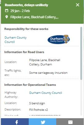
The methodology used in reaching decisions of this nature is a little bit more complex and technical than the way I’ve described it above so I’ve published the last item of correspondence I received from the council earlier this week to my query on behalf of the school and parents/carers of children in Hesleden. This explains the background and eventual outcome in more detail:

Hi Rob,


Further to your email, an assessment of the walking route from Hesleden to Wellfield is probably no longer necessary. The reason for this is that the GIS mapping system that is used and which is updated annually is now showing that the shortest route is to Wellfield. The following is an extract taken from the admissions information guide for parents that is posted on the website in September each year:


A Geographic Information System (GIS) is used to identify and measure the shortest route. In all cases the GIS identifies the route to be measured by connecting in a straight line the centre point of the child’s house or in the case of a flat from the centre point of the building, to the closest point on the nearest route on the Ordnance Survey MasterMap® Highways Network – Roads and the Ordnance Survey MasterMap® Highways Network – Paths to the nearest school site entrance.


This a national system which gets updated each year, and is not a DCC system. I have however asked colleagues in the council’s IT and Data Team with specific responsibility for GIS to investigate why the shortest route has changed and below are the results of that investigation.


I’ve had a look at the network around the area and confirm that there is a link missing from the processed network that was produced towards the end of 2020. Referring to the same area of the network that was processed in previous years 2018 and 2019, that break in the network isn’t present, although in the case of 2018 there was a break elsewhere which prevents the network from being complete.


I’ve delved into the raw data files that we received from Ordnance Survey, and indeed that missing piece as we see it is there. However the attribution behind it has changed. You may recall that at our initial meeting looking at how we can migrate from the Integrated Transport Network (ITN) dataset to the Highways Network that replaces it, we made a decision to only include Paths that had surfaceType attribution set to ‘Made Sealed’. As the piece of the network that no longer appears in the final processed dataset has its surfaceType now set to ‘Unmade’, this candidate feature is omitted from the network.


I appreciate that the above may be somewhat technical, but I think the basic explanation is that in 2019 the way the ordnance survey was set up, the whole route was attributed to be made sealed and therefore shown in its entirety from Hesleden to Shotton Hall Academy. In 2018 and 2020, parts of the route are attributed as being unmade and therefore the route ends where the unmade section occurs. This means there is no entire route to Shotton Hall Academy and Wellfield therefore becomes the nearest school.


To avoid potential instances in the future of changes to how the route is attributed on the mapping system, I have taken the decision that from now onwards Wellfield will be the nearest school to addresses in Hesleden, and as the distance to the school is more than 3 miles, pupils will be entitled to free home to school transport.


I hope this response is able to answer your query.

Friday 29 January 2021

Roadworks next month for Blackhall Colliery and Station Town

I've received confirmation of road works scheduled to take place over the next couple of weeks in Station Town and Blackhall Colliery. Please see full details below:


Road

No.

Location

Description

Traffic Management

Start

Date

End

Date

Responsibility


B1281

Hesleden Road

New telecom ducts and cabling

2/3 way lights

6 February

10 February

British Telecom


C22

Heaton Terrace, Station Town

New services

2 way lights

2 February

8 February

Northumbrian Water

Thursday 28 January 2021

First phase of safety measures at Chicken’s Green completed

A few months ago residents contacted me to express their concerns about motorbikes gaining access onto Chicken’s Green causing damage to the grassed area and also posing a danger to children playing on the field and in the play area nearby (please see posts dated Saturday 19 September 2020 and Monday 30 November 2020 for background details).

In response a site visit with the parish clerk, the clean and green team, community safety officers and members of the community action team was arranged to see what could be done to address public concerns. After considering options, including consultation with residents nearby, the agreed course of action was to install a number of ‘target-hardening’ measures at Chicken’s Green and other locations nearby to prevent access by motorbikes and other vehicles.

I’m pleased to report that the first phase has now been completed with anti-bike gates installed earlier this week at either side of the pathway across Chicken’s Green at the top of Dene Road and at Corry Close (please see image above). 

Additional works are scheduled to take place soon at the bottom of Corry Close, where boulders will be installed to prevent access through the gaps at the fence. The boulders are scheduled for delivery next week although they won’t be installed until the ground dries out sufficiently. 

Security works are also due to be carried out soon at the grassed area at the bottom of First Street and Aspatria Avenue (please see post dated Saturday 7 November 2020 for background details). I’ll update on progress with all these schemes closer to the time.

Wednesday 27 January 2021

Road works on Fillpoke Lane this weekend

I’ve been informed by the highways section that roadworks to repair potholes along Fillpoke Lane are scheduled to take place over this weekend, from Friday 28 January 2020. Details below:

Tuesday 26 January 2021

Postal Votes & 2021 Local Elections

Local elections are due to take place in County Durham on Thursday 6 May 2021 although they may be rescheduled to a later date if the government feels that voting cannot go ahead safely because of the Covid-19 pandemic. Either way you might want to consider voting by post.

Voting by post is an easy and convenient way of voting, especially if you are unable to go to your polling station on Election Day. Please see below for details:

Complete this  Icon for pdf Postal vote application form (PDF, 93.2kb)  to apply to vote by post. Please return it to the address on the form.

You can apply to vote by post for a particular election, for a set period of time, or for all future elections and referendums.

More information on postal votes can be found in the link here: http://www.durham.gov.uk/postalvote

Monday 25 January 2021

Signage for Crimdon Beach

I’ve just had an update today from the countryside rangers confirming that advisory signs are to be installed at the main access points to and from Crimdon beach in the hope of deterring people hanging bags full of dog waste on the fence at the approach to the main steps.


This follows complaints I’ve received from members of the public about irresponsible dog owners persistently refusing to dispose of their pet’s waste in the bins provided along the front at Crimdon, and also requests I’ve received for this type of signage as a first step towards addressing this awful practice (please see posts dated Wednesday 30 December 2020 and Monday 18 January 2021 for background details).

This is the message I received from the countryside team:

Hi Rob, after on-site meeting last week we are looking at putting in permanent metal signage at the main access points along the beach. This may take a little time to get the necessary design and agreement with Coastal Heritage but we hope this will be feasible and in place ASAP.

I’ll update on progress as soon as I have more information.

Monday 18 January 2021

Group to tackle environmental issues on the Durham Heritage Coast

I was contacted late last year by local residents and visitors expressing their concerns about a number of persistent anti-social behaviour and environmental issues taking place along the Durham Heritage Coast (please see post dated Saturday 21 November 2020 for more information on associated coastal issues). 

I’ve been dealing with related issues along the coast and in other locations for some time now so I raised these latest concerns with officers from the county council's Environment and Sustainable Communities Overview and Scrutiny Committee and the latest update received from the team is reproduced below. 

I will publish additional updates on developments and future plans as soon as I have more information from the team. In the meantime if you would like to raise any particular issue with the coastal team please contact me at: rob.crute@durham.gov.uk 


Cllr Crute, I refer to your query concerning the Heritage Coast – ASB and wished to provide you with a brief update on this.


Following receipt of your query we contacted officers at the Durham Heritage Coast and the Countryside Ranger who provided detail as to the number of incidents throughout the County giving locations, types of vehicle used and costs.  DHC advised that the Heritage Coast Partnership was setting up a group to look at what could be done to tackle the issue and prevent future incidents.


We have emailed the Head of Community Protection to make them aware that the issue is being raised and have we received a response from the Safer Communities Manager who is responsible for the Multi-Agency Problem Solving Groups across the county (MAPS).  She has confirmed that off-road vehicles and the resulting ASB are regularly discussed at these groups and that although a significant amount of work has been done they continue to discuss this issue and look at new ways to tackle it.


Both DHC and Countryside Rangers have been contacted to check that they are aware of the existence and work of the MAPS groups and have suggested that they may want to liaise and share information/intelligence with the Safer Communities Manager and her team which will then feed into the relevant MAPS group.  In addition, that in relation to the Heritage Coast Project group which has been established to look at ASB on the coast, that they may want to have a colleague from Safer Communities team on that group, if they don’t already, with a view to ensuring that all relevant agencies are involved and engaged in determining what action to be taken.


At our catch up meeting with the Chair and Vice Chair of ESCOSC (Environment and Sustainable Communities Overview and Scrutiny Committee) yesterday they confirmed that they would want including in the next Heritage Coast Update to the committee information on the number of ASB incidents resulting from off road vehicles, associated costs and action taken to address the issue and future plans.

Wednesday 13 January 2021

Solar Farm planning application referred to committee for decision

Last week I published an article containing details of a planning application received by Durham County Council’s planning office to install a solar farm on land at Sheraton (please see posts dated Sunday 1 November 2020 and Monday 4 January 2021 for background details).


Over the past week or so I’ve been contacted by several local residents objecting for a variety of reasons to this proposed development - details of the plans and public comments received to date can be found on the council’s planning portal at: https://publicaccess.durham.gov.uk/online-applications/search.do?action=simple&searchType=Application To access all associated documents enter planning code DM/20/03722/FPA into the search bar.

Given the significant amount of correspondence I've received from residents I’ve asked that this planning application be referred to the relevant planning committee for deliberation and decision. The case officer has acceded to my request and the application will be heard at committee in due course.

I will update on developments as and when I am notified, but in the meantime if you wish to submit your comments about this application please register them with the planning office using the link shown above. 

Sunday 10 January 2021

Footpath repairs update: A1086 Blackhall Rocks to Crimdon

Last year I published an update on pathway repair requests in our patch (please see post dated Tuesday 20 October 2020 for background details). 

Most requests for restructuring or resurfacing works have been met, with repairs carried out in many locations including:

  • on Mickle Road between Blackhall Rocks and High Hesleden
  • sections of the pathway between High Hesleden and Hesleden
  • between the railway bridge at Station Road and the picnic area at Blackhall Rocks
  • at Eden Cottages in Hesleden and 
  • at the structurally damaged pathway opposite South Blackhalls Farm on the Coast Road at Blackhall Rocks.

However repair works along one particular stretch of pathway on the A1086 Coast Road between Blackhall Rocks and The Seagull could not be completed. Along with the parish clerk I continued to press the highways office for works to be carried out at this location as soon as possible, partly because of the atrocious condition of the pathway surface and also because we felt it was essential to bring this stretch of pathway up to standard before the next summer season got underway, and in advance of the opening of the new Crimdon Hub later this year (please see posts dated Wednesday 14 October 2020 and Saturday 21 November 2020 for details of the Crimdon Hub and other schemes along the Durham Coast).

Consequently we were pleased to receive confirmation from the highways office last week that repair works to this stretch of pathway are to be prioritised for the coming year’s works programme - scheduled to commence in the spring. I’ll update on progress with this scheme closer to the start date, but in the meantime this is the confirmation we received from the highways office:

Good Morning Cllr Crute


We have now assessed this section of footway (Blackhall Rocks to the Seagull PH) and agree that it requires a capital maintenance scheme to resurface it. Therefore it will be added to our 2021/22 programme of works which will begin to be constructed on-site from the April 2021.


I appreciate your comments regarding the new hub and visitors so we will endeavour to make this scheme one of the ones we tackle at the start of the works programme.

Saturday 9 January 2021

Update on traffic calming concerns at Station Town

Late last month I was contacted by residents in Station Town concerned about reported traffic collisions and persistent damage to the chicane on the B1280 approach from Wingate.


I contacted the highways office at county hall and also the traffic management officer at Durham constabulary to clarify the extent of accidents at this location, and also to request whichever measures are necessary to make this area safe are carried out as soon as possible. I received the response below from the police traffic management office earlier this week:

Hi Rob,


Thank you for the below in which you raise local concerns regarding the chicane located on B1280 Station Road at Station Town when leaving Wingate.


I have taken a look at our accident recording system for the past 2 years and can find no collisions recorded for this location.


I have also taken a look at our incident logs for the past year and can find no incidents recorded associated with this chicane.


If collisions are occurring I suspect they must be damage only for which either they are not getting reported to the Police or there is no requirement for the Police to record them on the collision recording system, hence a nil return.


This location has not been raised with me as a concern site in the recent past.


I believe the chicane here is subject of priority signing on both approaches and give-way road markings but I’m sure the highways officer will have the condition of the signs and road markings reviewed when resources permit.


Hope this goes some way to answering your query.


Regards


Residents have expressed their particular concerns about highway marking and advisory signage in this area which is reported to be causing some confusion to motorists as they approach the chicanes. I agree that measures need to be put in place as soon as possible to prevent any further incidents at this location so I’ve contacted the highways office to ask their guidance on how best to deal with local concerns. I’ll update on progress as soon as I have a response from the service.

Finally I’m aware that the clerk to the local parish council is also dealing with similar queries in relation to the chicanes so I’m hopeful that by working together we’ll find a solution soon.

Thursday 7 January 2021

Roadworks on the A1086 Coast Road

Shortly before Christmas I published advance notification of road works scheduled to take place later this week along the A1086 Coast Road between Blackhall Colliery and Blackhall Rocks (please see post dated Friday 18 December 2020 for details).


Those road works are scheduled to commence tomorrow morning so following queries from residents in the immediate area I asked the highways services team for information about the likely impact of the works on residents' access to their properties along the Coast Road. This is the response I received this afternoon:

Access will be maintained as much as possible for residents to avoid too much disruption, we will also have a DCC supervisor and traffic management supervisors on site at all times should anyone need any assistance or have any questions.

The only time that access will be fully restricted will be when the existing surface is being planed off and when the new surfacing material is laid, this will only be for a short period of time. The works will be carried out in phases, however we are unable to fully confirm the extents of those due to the weather.

There will be traffic signals in place and these will be in line with each phase of the works, so it will not be the full extent of the works. They will also be manually controlled in order to have as little delay as possible. It will be 2 way lights for the straight stretches of road, and we will have 4 way lights for the junction at Station Road/Mickle Hill Road. Notification letters were also delivered in advance, they contain the contact numbers if residents do have any problems or questions throughout the works.

Monday 4 January 2021

Planning application to install a solar farm at Sheraton

Last year I published an article on this site referring to initial proposals to install a solar farm on land at Sheraton (please see post dated Sunday 1 November 2020 for details).


Just before Christmas I received confirmation from the planning office that a formal planning application had been submitted seeking consent to install and operate a solar farm at Sheraton Hall Farm. The application is currently scheduled to be decided by delegated authority, although there is an option for it to be submitted to the planning committee for consideration and decision if there are material planning concerns.

If you have an interest in this application and would like to submit your comments for consideration I would urge you to record them as soon as possible on the DCC planning portal. Please follow the link below for details:


The planning case officer can be contacted by email at: chris.shields@durham.gov.uk and I can be contacted by email at: rob.crute@durham.gov.uk